The importance of satellite technologies for land monitoring and emergency management
Giulia
1 June 2023
1 June 2023
The importance of satellite technologies for land monitoring and emergency management
The essential contribution of satellite datasets and constant monitoring in dealing with adverse events resulting from climate change.
The application of satellite data and imagery has benefits not only in optimising agricultural activities and plot management but is also increasingly a key tool in climate emergencies such as those we are experiencing in our country.
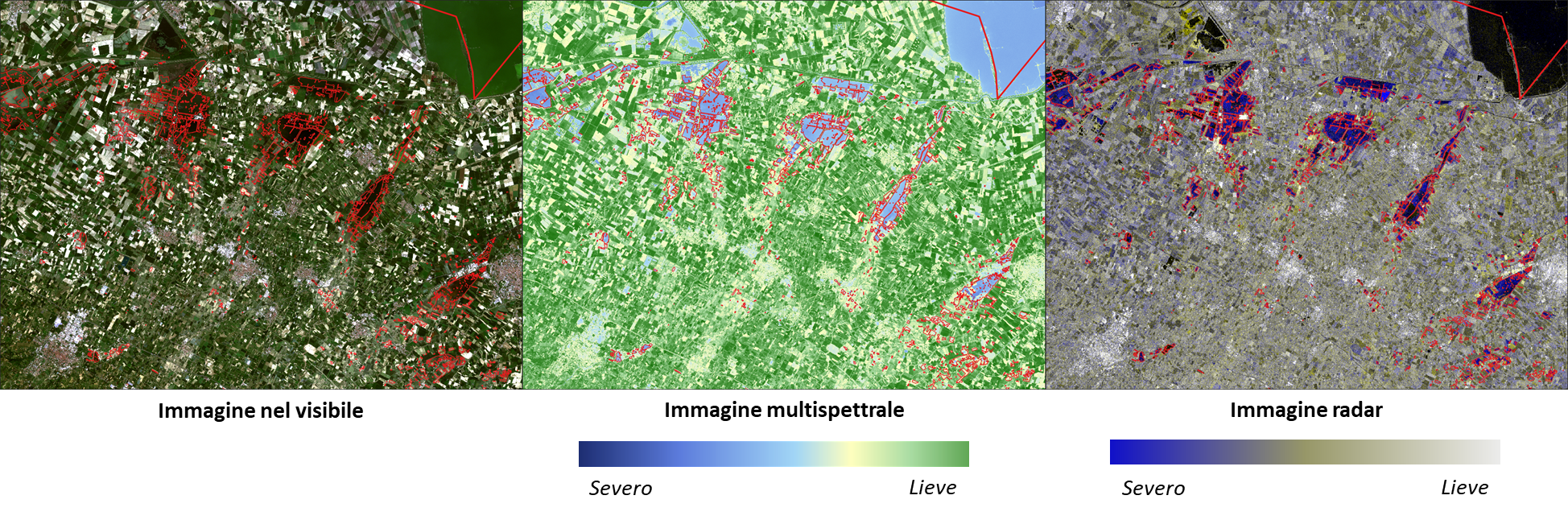
Having an Earth Observation dataset with increasingly reliable estimates is necessary to monitor, investigate and quantify adverse climate events and damage they cause to the land. Satellite observation, for example, allow collecting data on the size of emergency phenomena such as flooding, such as water flow rate, and the path traced by floods, so that any new hazards can be prevented.
These technologies allow using data from radar satellites identifying affected areas and assessing the level of flooding, comparing the results with levels of the past and combining data with aerial reconnaissance data to classify affected areas and estimate flood severity.
In addition to flood monitoring, the use of data from EO allows tracking of emergencies progression and damage they have caused to land parcels in the affected areas. With data on plot geometries and information on crops in the field, the vegetative progress of crops can be monitored, assessing their real damage.
Esa images reprocessed from ABACO
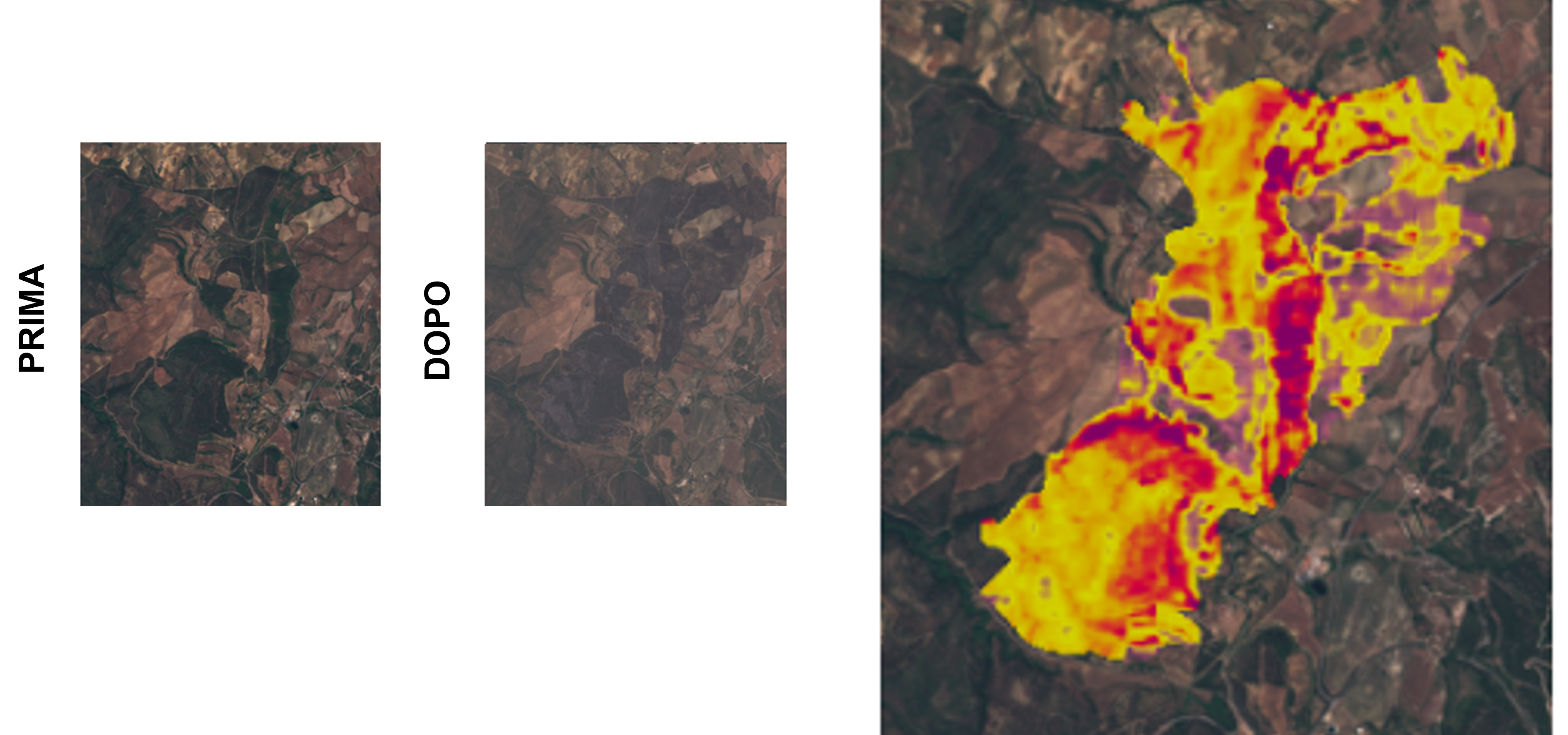
Information made available by technology can also be leveraged to assess damage from wildfires, one of the causes of soil erosion. This has become-increasingly frequent as global warming worsens. The ESA can help improve and speed up operations related to restoration of interested land, while also managing its economic impact.
Esa images reprocessed from ABACO
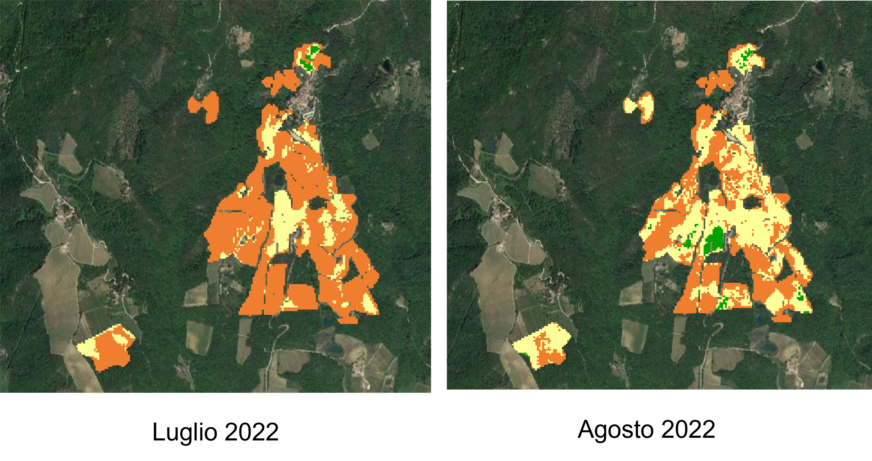
Like flooding , the same is true for drought, an opposite but related phenomenon which can be monitored with innovative satellite imaging systems integrated with sensors and then reprocessed as data for decision support.
Esa images reprocessed from ABACO
The application of satellite technology is essential, and its use is increasingly broad, such as the goal of removing carbon from the atmosphere. Through regular monitoring, satellite imagery of forest cover will aid in carbon capture.
When we talk about Earth Observation, we think of monitoring what is happening on the ground, but datasets also provide evidence of the remaining 70 percent of our planet, which is covered by water. In fact, technology is coming into the field to monitor the melting of the ice sheets; one of the signs of climate change. This will provide new information about significant changes in ocean temperature and global precipitation.
The application of new technologies, such as satellite imagery and remote-sensing, therefore, can avoid, or at least lessen, the consequences and damage due to changing climate conditions. Constant monitoring of these datasets can enable researchers to gain insight into long-term trends and variations, improve model predictions and increase understanding of variable, with the goal of preserving the ecosystem as much as possible and better managing recovery and compensation operations in areas affected by adverse events.